
Georgia Silhouette: What Does Georgia Outline Look Like On A Map?
Guessing the Worldle answer in a single try (what many players call a 1/6 win) is only possible if you are familiar with the map outlines of different countries. Recognizing these shapes usually takes time, practice, and a genuine interest in learning the silhouettes of countries around the world.
In this post, we’ll take a closer look at the silhouette of Georgia. Georgia was the Worldle answer for March 8, 2026, so if you played the game on that day or plan to try it through a Worldle Archive, you might find this guide especially helpful.
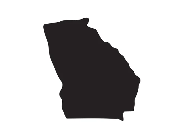
Below, you’ll see what the Georgia silhouette looks like along with some useful facts about the country, including its location, capital city, neighboring countries, and other details that help explain the country behind the outline.
Georgia Silhouette
Georgia Location
Georgia is located in the South Caucasus, a region that sits at the crossroads of Eastern Europe and Western Asia.
The country lies along the eastern coast of the Black Sea and is surrounded by mountainous landscapes, particularly the impressive Caucasus Mountains to the north.
Because of this position between continents, Georgia has historically served as a bridge between European and Asian cultures, trade routes, and civilizations.
Continent or Region that Georgia Belong To
Georgia is generally considered part of the South Caucasus region, together with Armenia and Azerbaijan.
Geographically, the country sits in Western Asia, but culturally and politically it is often associated with Eastern Europe. This dual identity is one reason Georgia has such a rich blend of traditions and history.
Georgia Capital City
The capital city of Georgia is Tbilisi.
Located along the banks of the Kura River, Tbilisi is the largest city in the country and serves as its political, economic, and cultural center. The city is known for its historic architecture, hilltop fortresses, and diverse mix of Eastern and European influences.
Major Cities in Georgia
Besides Tbilisi, several other cities play important roles in the country:
- Batumi – a popular seaside city on the Black Sea known for tourism and modern architecture.
- Kutaisi– one of the oldest cities in the region and historically an important cultural center.
- Rustavi – a major industrial hub located southeast of Tbilisi.
- Gori – known as the birthplace of Joseph Stalin.
Each of these cities contributes to Georgia’s economy, culture, and regional identity.
Georgia Borders
Georgia sits among several neighboring nations. It shares borders with:
- Russia to the north
- Turkey to the southwest
- Armenia to the south
- Azerbaijan to the southeast
The western side of Georgia opens to the Black Sea, giving the country important access to maritime trade routes.
How Big Is Georgia?
Georgia covers an area of about 69,700 square kilometers (26,900 square miles).
Although it is not a large country, its landscape is extremely diverse. Within its borders you can find:
- Towering mountain ranges
- Fertile valleys
- Coastal plains along the Black Sea
- Forests and alpine regions
The country’s population is roughly 3.7 million people, making it relatively small compared with many other nations in the region.
Why Does Georgia’s Silhouette or Outline Look the Way It Does?
The outline of Georgia is strongly influenced by natural geography and historical borders.
The Caucasus Mountains form a natural boundary with Russia to the north, while valleys and river systems helped define internal regions and settlement areas. Over centuries, political agreements, wars, and shifting empires also shaped the country’s modern borders.
Because of this combination of mountains, rivers, and historical developments, Georgia’s silhouette appears slightly irregular but distinct.
Are There Similar-Looking Country Shapes?
The silhouette of Georgia can resemble nearby countries at first glance, especially those in the Caucasus region.
For example:
- Armenia has a compact shape that can appear somewhat similar in small map icons.
- Azerbaijanmay also be confused, especially when you are trying to figure out answers for silhouette-based geography games.
However, Georgia’s Black Sea coastline and the curve of its northern border against the Caucasus Mountains usually help distinguish it.
Five Interesting Facts About Georgia
Here are five quick facts about Georgia:
- One of the oldest wine cultures in the world: Georgia is widely believed to be the birthplace of wine, with winemaking traditions dating back over 8,000 years.
- Unique alphabet: The Georgian language uses its own writing system known as the Georgian alphabet, which is unlike any other script.
- Mountain landscapes: Much of the country is dominated by the dramatic peaks of the Caucasus Mountains.
- Historic trade routes: Georgia was once an important stop along the ancient Silk Road.
- Rich cultural heritage: The country has centuries-old monasteries, fortresses, and churches, many of which are located in scenic mountain settings.