
Kenya Silhouette: What Does Kenya Outline Look Like On A Map?
Guessing the Worldle answer in a single try (what many players call a 1/6 win) is only possible if you are familiar with the map outlines of different countries. Recognizing these shapes usually takes time, practice, and a genuine interest in learning the silhouettes of countries around the world.
In this post, we’ll take a closer look at the silhouette of Kenya. If you encountered Kenya while playing Worldle or another geography puzzle, learning more about the country behind the outline can make the silhouette much easier to remember.
Below, you’ll see what the Kenya silhouette looks like along with some useful facts about the country, including its location, capital city, neighboring countries, and other details that help explain the country behind the outline.
Kenya Silhouette
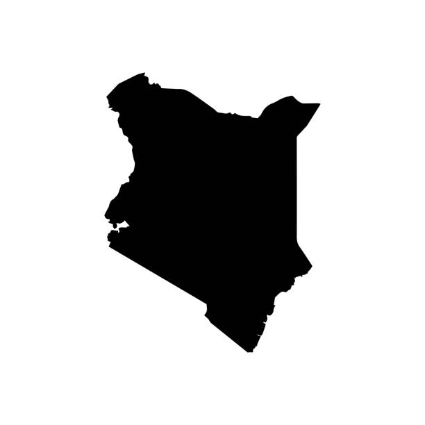
Kenya Location
Kenya is located in East Africa, along the eastern side of the African continent.
The country sits along the coast of the Indian Ocean and stretches inland toward the highlands and the Great Rift Valley. Its location places it near the equator, which means much of the country experiences warm weather throughout the year.
Because of its position in East Africa, Kenya has long been an important center for trade, wildlife tourism, and regional culture.
Continent or Region That Kenya Belongs To
Kenya belongs to the continent of Africa and is part of the East African region.
It is also a member of the East African Community, a regional bloc that promotes economic cooperation between several East African countries.
Kenya Capital City
The capital city of Kenya is Nairobi.
Nairobi is the largest city in the country and serves as Kenya’s political, economic, and cultural center. It is one of the most influential cities in Africa and is known for its modern skyline, vibrant economy, and unique attractions such as Nairobi National Park, a wildlife park located just outside the city center.
Major Cities in Kenya
Besides Nairobi, several other cities are important to the country:
- Mombasa – a major port city on the Indian Ocean and one of the oldest cities in East Africa.
- Kisumu – an important city located along the shores of Lake Victoria.
- Nakuru – known for its nearby national parks and beautiful landscapes.
- Eldoret – a fast-growing city famous for producing world-class long-distance runners.
Each of these cities contributes to Kenya’s economy, culture, and regional development.
Kenya Border
Kenya shares borders with several countries in East Africa:
- Ethiopia to the north
- Somalia to the east
- Tanzania to the south
- Uganda to the west
- South Sudan to the northwest
The southeastern side of the country borders the Indian Ocean, giving Kenya access to important maritime trade routes.
How Big Is Kenya?
Kenya covers an area of about 580,000 square kilometers (224,000 square miles).
This makes Kenya one of the larger countries in East Africa. Its landscape is extremely varied and includes:
- Highlands and mountain ranges
- The famous Great Rift Valley
- Savannah grasslands
- Coastal beaches along the Indian Ocean
- Lakes and forests
The country has a population of over 50 million people, making it one of the most populous nations in the region.
Why Does Kenya’s Silhouette or Outline Look the Way It Does?
The outline of Kenya is shaped largely by colonial-era borders, natural geography, and historical agreements.
During the late 19th and early 20th centuries, European colonial powers established borders across many parts of Africa. These boundaries later became the official borders of modern African countries after independence.
Natural features such as lakes, valleys, and mountain ranges also influenced parts of Kenya’s borders, helping create the distinctive silhouette seen on maps today.
Are There Similar-Looking Country Shapes?
Some people find that the silhouette of Kenya can resemble nearby countries when viewed quickly in geography games.
For example:
- Tanzania shares a somewhat similar regional position and large shape.
- Uganda may occasionally be confused with Kenya in smaller map outlines.
However, Kenya’s Indian Ocean coastline and its northeastern extension toward Somalia usually make its silhouette easy to identify once you become familiar with it.
Five Interesting Facts About Kenya
Here are five quick facts about Kenya:
1. Home to the Great Rift Valley: A large portion of the Great Rift Valley runs through Kenya, creating dramatic landscapes and lakes.
2. Famous for wildlife safaris: Kenya is known for national parks such as Maasai Mara National Reserve, where visitors can see lions, elephants, and other iconic animals.
3. World-class long-distance runners: Many of the world’s best marathon runners come from Kenya, especially from the highland regions.
4. Diverse cultures: Kenya is home to more than 40 ethnic groups, each with its own language and traditions.
5. Mount Kenya: The country is named after Mount Kenya, the second-highest mountain in Africa after Mount Kilimanjaro.